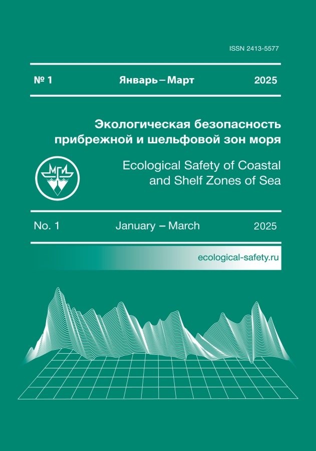
Ecological Safety of Coastal and Shelf Zones of Sea

Journal Information

ISSN (print): 2413-5577

Media registration certificate: ПИ № ФС77-73714 from 21.09.2018

Founder: Marine Hydrophysical Institute of the Russian Academy of Sciences (RAS)

Editor-in-Chief: Yuri N. Goryachkin, Doctor of Sciences

Frequency / Access: 4 issues per year / Open

Included in: Higher Attestation Commission list, RISC, Scopus,  RSCI

About the Journal

The journal aims to publish results of original scientific research concerning the state and interaction of geospheres (atmosphere, lithosphere, hydrosphere, biosphere) within coastal and shelf areas of seas and oceans, methods and means of their study, the ecological state of these areas under anthropogenic influence, and issues related to environmental protection.

Objectives

  • Share research results with national and international experts.
  • Improve the quality of academic papers.
  • Provide assistance to scholars, especially young ones, in preparing articles that meet current publication and research ethics standards.
  • Create and develop scientific foundations for ecologically sound management of coastal and shelf zones, assess impacts of constructions in these areas, foster the conservation of beaches and recreational zones, and prepare scientifically justified recommendations for local government authorities involved in planning and executing environmental protection measures.
  • Draw the general public's attention to environmental protection issues.

Ағымдағы шығарылым

№ 1 (2025)

Мұқаба

Бүкіл шығарылым

Статьи

Assessment of SKIRON and ERA5 atmospheric forcing for the reconstruction of the Black Sea circulation based on hydrophysical modeling results
Dymova O., Miklashevskaya N.
Аннотация

A modeling of the Black Sea circulation for 2016 was carried out with different sets of atmospheric forcing data to determine the optimal atmospheric forcing for retrospective analysis of hydrophysical fields. An eddy-resolving z-model of Marine Hydrophysical Institute with a resolution of 1.6 km was used for the calculations. Differences in the circulation structure for the two experiments were revealed. It was shown that in the SKIRON experiment compared to ERA5, the cyclonic circulation of the Black Sea was weakened, the isopycnic surfaces were aligned, and the cold intermediate layer was not determined by the 8°C isotherm due to the underestimation of the solar radiation flux and weakening of the wind influence. A comparison of the model thermohaline characteristics calculated using ERA5 and SKIRON atmospheric forcings and measurement data of temperature and salinity obtained by ARGO profiling floats and onboard equipment in 87, 89, 91 cruises of R/V Professor Vodyanitsky was carried out. According to the validation results, it was obtained that in the upper 300-meter layer, for all measurement stations the mean RMSE of temperature and salinity in the ERA5 experiment were 28 and 17% lower, respectively, than the RMSE calculated from the SKIRON data.

Ecological Safety of Coastal and Shelf Zones of Sea. 2025;(1):6-25
pages 6-25 views
Wind field retrieval in the coastal zone using X-band radar data at large incidence angles
Korinenko A., Malinovsky V.
Аннотация

The paper aims to develop a geophysical model function that allows retrieval of the wind speed vector from a radar signal scattered from the sea surface. During in situ experiments on the stationary oceanographic platform in 2022–2024, a database was created which contained radar information, frequency spectra of sea surface elevations, wind speed and direction, and geometric properties of breaking wave crests in the active phase. An MRS-1011 360-degree marine radar (X-band, 3 cm wavelength) transmitting and receiving horizontally polarized signal at large incidence angles was used in the experiments. For these observation conditions, the main informative parameter that governs the radar cross section is the fraction of the sea surface covered by wind wave breaking crests (whitecap coverage). The role of this parameter is qualitatively confirmed by the fact that the radar power and whitecap coverage have similar wind speed dependencies. It was shown that the radar cross section was proportional to the whitecap coverage with 1.47 as the proportionality coefficient. The intensity of wave breaking also depends on the wave age, which leads to the dependency of the radar cross section on the wave development stage. The influence of the wave age on the radar signal level was confirmed experimentally. It was shown that the level of the wind dependency of the radar signal in the “up-wind” direction increased by a factor of 5 when the wave age increased from 0.1 to 1.2. Based on the in situ data and physical grounds of the sea surface radar backscatter formation, we suggest a geophysical model function allowing retrieval of wind speed fields in areas within a radius of about a kilometer. The error in wind speed vector magnitude and direction retrieved from radar data was 1.2 m/s and 30°, respectively, compared to the data obtained by the anemometer.

Ecological Safety of Coastal and Shelf Zones of Sea. 2025;(1):26-41
pages 26-41 views
The Danube River water discharge according to satellite optical data of the Landsat series
Suslin V., Sholar S., Podgibailov E., Martynov O.
Аннотация

The paper aims to find the correlation relationship between the land–water area ratio for a fixed area of the Danube Delta and the total river discharge using Landsat series satellite products and SMHI Hypeweb hydrological model. The study period covered 1984–2010. We used a total of 132 satellite images in one band in the near-infrared spectral range with a spatial resolution of 30 m. Two study areas were selected: the delta area with channel and land (44.9–45.4° N, 29.55–29.60° E) and the control area of the mouth seashore (44.9–45.4° N and 29.80–29.85° E). For each of them a histogram was plotted which characterised the reflected light in relative units and their corresponding numbers of pixels. The signal from the first area was found to be in the range of 7000–26,000 r.u., whereas from the second one it was 7000–8000 r.u. This distinction allowed us to separate the delta areas occupied by river water from those of land. For this purpose, we calculated the ratio between the number of pixels corresponding to a value of 7000–8000 r.u. to all pixels in the area. Then we found the correlation between the river discharge from the SMHI Hypeweb hydrological model and the proportion of pixels corresponding to areas occupied by water. The regression y = 7.78∙10–4∙x 0.09 – 5.98∙10–4 was obtained. The analysis of seasonal variability showed that in the studied delta area, the share of pixels related to water-occupied areas > 0.5 corresponds to the months from March to May, and the minimum values < 0.3 correspond to July–September. All this is consistent with the period of intensity of precipitation and snowmelt in the Danube River basin area. The data from this work may be useful to researchers assessing the impact of this river discharge on the hydrological regime and condition of the Black Sea.

Ecological Safety of Coastal and Shelf Zones of Sea. 2025;(1):42-50
pages 42-50 views
Transformation of the western branch of the Bakalskaya Spit (Northwestern Crimea) as a result of the storm on 26–27 november 2023
Krylenko V., Goryachkin Y., Krylenko M., Divinsky B.
Аннотация

Accumulative marine coastal forms of the Black Sea are exposed to a number of natural threats, including sea level rise and increased wave action. Monitoring of accumulative forms dynamics in order to timely identify adverse trends in their development is a necessary component for coastal zone management and the development of coastal protection measures. The aim of the work is to determine the qualitative and quantitative characteristics of the transformation of the western branch of the largest accumulative form in the northwestern coast of Crimea – the Bakalskaya Spit as a result of the storm on 26–27 November 2023. We used cartographic, literary and archival sources as well as remote sensing data, materials of long-term monitoring observations and results of mathematical modeling. In terms of wave parameters and overall power, the 26–27 November 2023 storm was extremely strong but not unique, and in terms of power and other wave parameters it is comparable to the 11 November 2007 storm. It was found that during the extreme storm, the accumulative body shifted to the east. The magnitude of the displacement varies significantly along the length of the spit and exceeds the magnitude of the main shore retreat. The position of zones with different magnitudes of the coastal bar displacement or formation of washouts does not coincide with that in previous storms. Differences in the character and scale of the accumulation body transformation are determined by local in terms of time and space conditions, primarily by the relief of the underwater slope and beach at the time of storm formation. Monitoring of the accumulative body dynamics following the storm recorded self-restoring processes confirming that the lithodynamic system had not been not brought out of the dynamic equilibrium.

Ecological Safety of Coastal and Shelf Zones of Sea. 2025;(1):51-71
pages 51-71 views
Testing of a piled (permeable) breakwater made of composite materials for coastal protection. Part 2. Evaluation of impact on the shore state
Chubarenko B., Dikii D., Domnin D., Zakirov R., Babakov A., Paka V., Kondrashov A., Korzh A., Burnashov E., Karmanov K., Bass O., Efremov V., Ryabkova O.
Аннотация

The paper analyzes the effectiveness of a pile breakwater structure Grebenka for coastal protection purposes. From 03.10.2020 to 30.04.2023, full-scale testing of the structure was conducted on the northern shore of the Kaliningrad Oblast near the city of Zelenogradsk between the eroded and accumulative shore segments. Four breakwater modules were installed in a single line in the groin pocket at a depth of about 2 m offshore of the groin end but did not completely overlap the pocket. One module was installed in the immediate vicinity of the shoreline. The experiment covered several seasons of severe storms, which allowed us to compare the shoreline dynamics at the breakwater installation site and in the neighbouring areas. We carried out regular measurements of the beach width, aerial survey, repeated depth measurement at the installation site and assessed the underwater slope dynamics. We also determined the thickness of the sand cover layer at the structure installation site and placed tilting flow velocity sensors on the breakwater. It was found that the beach width at the breakwater installation site and in adjacent areas was changing synchronously. The absence of an obvious accumulative effect behind the installed breakwater was, first, due to the displacement of the breakwater modules and their partial immersion in the sand and, second, due to the limited line length of the offshore modules in proportion to their distance from the shoreline. A temporary positive effect was achieved only for a solitary module as periodic beach progradation to the root of an old groin adjacent thereto from the east. The results of the full-scale test will be used to further improve the breakwater design.

Ecological Safety of Coastal and Shelf Zones of Sea. 2025;(1):72-95
pages 72-95 views
Intensity of coastal upwellings of the Southern Coast of Crimea and their impact on the oxygen regime of the water area
Sovga E., Khmara T., Mezentseva I.
Аннотация

The paper analyses long-term data of the MHI Oceanological Data Bank for spring-summer seasons (May–September) of 1986–2000 and 2007–2023 and assesses the conditions of upwelling occurrence, their duration, influence on the change of temperature and oxygen regimes and content of nutrients in the water area of Goluboy and Yalta Bays. Fourteen upwellings were detected during the mentioned periods. The volume of analysed data was 3288 values of depth, temperature, sigma-t, oxygen content and nutrients. Upwellings recorded in the first period (1986–2000) were observed only in the Yalta Bay water area. They are characterised by large temperature variations, significant changes in sigma-t and for May upwellings by very high values of oxygen content. An analysis of the current MHI database from 2007 to 2023 allowed us to identify upwellings in the waters of Goluboy Bay, including the area of the stationary oceanographic platform, in July 2007, May 2010, 2012 and 2013, June and September 2013 and June 2021. We compared the temperature, coastal sigma-t and oxygen content for May and June 2012, 2013 and June 2021 and concluded that the intensity of upwellings had significantly decreased, the reasons for which are still unclear and may require further research. The paper considers differences in the content of biogenic nitrogen and phosphorus in the coastal water areas of the Southern Coast of Crimea during upwellings. These differences were manifested in the increase in the content of mineral forms of phosphorus and insignificant change in the content of mineral complexes of nitrogen. The analysis of the used database for these periods showed the insufficiency of target measurements and the need to adjust the monitoring system, especially in the spring–summer period, when the probability of upwelling is maximum.

Ecological Safety of Coastal and Shelf Zones of Sea. 2025;(1):96-111
pages 96-111 views
Organic matter in the waters of the Russian sector of the Caspian Sea
Degtyareva L., Bakun O., Ocheretniy M.
Аннотация

The paper aims to analyse the results of long-term studies of dissolved and suspended organic matter content in the waters of the Northern Caspian and Middle Caspian in the Russian sector of the Caspian Sea. The paper analyses the main sources of input of organic matter, itsseasonal and inter-annual variability, features of its spatial distribution and causes (allochthonous organic matter flow, production and destruction, water temperature, sea level changes, etc.) determining the spatial and temporal dynamics of organic matter content. Thepaper is written on the results of production environmental monitoring conducted atthelicensed areas of LLC LUKOIL-Nizhnevolzhskneft in 2017–2021. The organic matter amount was estimated by organic carbon. The dissolved organic carbon concentration was found to vary from 0.10 to 9.30 mg/dm3 in the surface water layer and from 0.10 to 9.60mg/dm3 in the bottom layer. The maximum enrichment of waters with dissolved organic matter was noted in the northern part of the water area. The concentration of suspended organic carbon in the surface water layer varied within 0.10–23.40 mg/dm3, whereas inthebottom water layer it ranged within 0.05–19.40 mg/dm3. The spatial distribution of suspended organic matter was characterized by seasonal shifts of the area with maximum concentrations northwards. The main factors affecting the organic matter content in water were water temperature, suspended matter concentration in water and hydrogen ion concentration. The level of dissolved and suspended organic matter has not changed in the last 20years of studies. The dependence of dissolved and suspended organic matter concentrations on environment pH indicates the natural origin of the organic matter in the waters of the monitored sea area.

Ecological Safety of Coastal and Shelf Zones of Sea. 2025;(1):112-123
pages 112-123 views
Assimilation capacity of Azov Sea bottom sediments with respect to copper and zinc
Bufetova M.
Аннотация

The work aims to assess the assimilation capacity of bottom sediments of the Sea of Azov with respect to copper and zinc by the level of their elimination into the geological depot as a result of sedimentation. The paper analyses metal concentrations in water and bottom sediments in 1991–2023. In 1998–2023, the average values of copper in sea water exceeded MAC (5 µg/L) and ranged 5.2–12 µg/L. The average concentration of copper in the bottom sediments of the Sea of Azov in 1991–1999 was 29.8 µg/g, in 2000–2010 it was 35.5 µg/g and in 2011–2023 it was 9.3 µg/g. The copper flux from the water to the bottom sediments of the open part of the sea ranged 14–381 t/year, whereas in Taganrog Bay it was 16–153 t/year. Sediment turnover periods of copper in the open sea and in Taganrog Bay averaged 0.5 and 1.6 years, respectively. The assimilation capacity of bottom sediments for copper in the open sea was 135.6 t/year and for Taganrog Bay it was 75.7 t/year. The zinc concentration in water exceeded its maximum permissible concentration (50 µg/L) in different years (up to 79 µg/L in Kuban-Akhtarsky and Kuban-Temryuksky districts). In the bottom sediments, the zinc concentration during the entire observation period was in the range of 17.1–98 µg/g in the open sea and 19.0–111 µg/g in the bay. The flux of sedimentation self-purification of water from zinc in the open sea was in the range of 175–902 t/year and in Taganrog Bay it was 76–407 t/year. The zinc turnover period in the open part of the sea varied within 0.7–39.8 years and in the bay, it was 0.1–4.8 years. The assimilation capacity of the bottom sediments with respect to zinc was 313.6 t/year for the open part of the sea and 169.1 t/year for Taganrog Bay. Determination of assimilation capacity of bottom sediments allows normalizing planned inputs of copper and zinc into the water area of the Sea of Azov.

Ecological Safety of Coastal and Shelf Zones of Sea. 2025;(1):124-136
pages 124-136 views
The dynamics of the mollusks Mytilaster lineatus settlement in the black sea waters with different degrees of petroleum pollution
Tkachenko Y., Tikhonova E., Viter T.
Аннотация

The paper estimates the dynamics of the settlement of mytilasters in the coastal water area with different degrees of petroleum pollution using the example of Sevastopol Bay (high level of anthropogenic load) and Laspi Bay (conditionally clean water area). To assess the marine environment quality at the sites of mytilaster fouling in the mentioned bays, data on the petroleum hydrocarbons content in the water was analysed (2012, 2015, 2018). The study material was samples of Mytilaster lineatus mollusks and bottom sediments taken in Sevastopol Bay from 2012 to 2018 at depths from 7 to 17 m during three sanitary and biological surveys. The abundance of mytilasters on various natural and artificial substrates of Sevastopol Bay in 2012, 2015 and 2018 under conditions of chronic oil pollution was analysed. It was revealed that the abundance of mytilasters on solid substrates was primarily influenced not by pollution of the marine environment but by water temperature and surf-wave phenomena. The values of the index of functional abundance show that under chronic petroleum pollution, mytilasters, inhabiting artificial substrates of Sevastopol Bay, make a more significant contribution to transformation of matter and energy. At the same time, the energy significance of the studied mollusks in the soils of Sevastopol Bay is considerably lower than that in the conditionally clean water area (Laspi Bay). An analysis of average abundance and biomass of mollusks for 2012, 2015 and 2018 showed that the number of mytilasters in the marine soils of Sevastopol Bay increased. It was established that the quality of life of the community was influenced by the physical and chemical parameters of bottom sediments, which either accelerate or slow down the oxidation processes, thereby changing the oxygen level in the bottom sediments. According to the correlation analysis results, there is a direct relationship between the abundance, biomass of mollusks and concentrations of chloroform-extractable substances, petroleum hydrocarbons and redox potential. It was revealed that in the soils of Laspi Bay, the quantitative indicators of mytilasters were four times higher than in Sevastopol Bay.

Ecological Safety of Coastal and Shelf Zones of Sea. 2025;(1):137-154
pages 137-154 views

Согласие на обработку персональных данных с помощью сервиса «Яндекс.Метрика»

1. Я (далее – «Пользователь» или «Субъект персональных данных»), осуществляя использование сайта https://journals.rcsi.science/ (далее – «Сайт»), подтверждая свою полную дееспособность даю согласие на обработку персональных данных с использованием средств автоматизации Оператору - федеральному государственному бюджетному учреждению «Российский центр научной информации» (РЦНИ), далее – «Оператор», расположенному по адресу: 119991, г. Москва, Ленинский просп., д.32А, со следующими условиями.

2. Категории обрабатываемых данных: файлы «cookies» (куки-файлы). Файлы «cookie» – это небольшой текстовый файл, который веб-сервер может хранить в браузере Пользователя. Данные файлы веб-сервер загружает на устройство Пользователя при посещении им Сайта. При каждом следующем посещении Пользователем Сайта «cookie» файлы отправляются на Сайт Оператора. Данные файлы позволяют Сайту распознавать устройство Пользователя. Содержимое такого файла может как относиться, так и не относиться к персональным данным, в зависимости от того, содержит ли такой файл персональные данные или содержит обезличенные технические данные.

3. Цель обработки персональных данных: анализ пользовательской активности с помощью сервиса «Яндекс.Метрика».

4. Категории субъектов персональных данных: все Пользователи Сайта, которые дали согласие на обработку файлов «cookie».

5. Способы обработки: сбор, запись, систематизация, накопление, хранение, уточнение (обновление, изменение), извлечение, использование, передача (доступ, предоставление), блокирование, удаление, уничтожение персональных данных.

6. Срок обработки и хранения: до получения от Субъекта персональных данных требования о прекращении обработки/отзыва согласия.

7. Способ отзыва: заявление об отзыве в письменном виде путём его направления на адрес электронной почты Оператора: info@rcsi.science или путем письменного обращения по юридическому адресу: 119991, г. Москва, Ленинский просп., д.32А

8. Субъект персональных данных вправе запретить своему оборудованию прием этих данных или ограничить прием этих данных. При отказе от получения таких данных или при ограничении приема данных некоторые функции Сайта могут работать некорректно. Субъект персональных данных обязуется сам настроить свое оборудование таким способом, чтобы оно обеспечивало адекватный его желаниям режим работы и уровень защиты данных файлов «cookie», Оператор не предоставляет технологических и правовых консультаций на темы подобного характера.

9. Порядок уничтожения персональных данных при достижении цели их обработки или при наступлении иных законных оснований определяется Оператором в соответствии с законодательством Российской Федерации.

10. Я согласен/согласна квалифицировать в качестве своей простой электронной подписи под настоящим Согласием и под Политикой обработки персональных данных выполнение мною следующего действия на сайте: https://journals.rcsi.science/ нажатие мною на интерфейсе с текстом: «Сайт использует сервис «Яндекс.Метрика» (который использует файлы «cookie») на элемент с текстом «Принять и продолжить».